
THE TENNESSEE VALLEY-The threat for strong storms with tornado activity is high for the area according to the National Weather Service. Starting later today and into tomorrow with the threat increasing:
Lauderdale-Colbert-Franklin AL-Lawrence-Limestone-Madison-Morgan-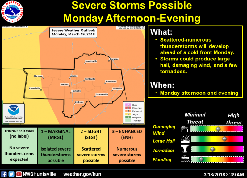
Marshall-Jackson-De Kalb-Cullman-Moore-Lincoln-Franklin TN-
456 AM CDT Sun Mar 18 2018
This Hazardous Weather Outlook is for north Alabama and portions of
southern middle Tennessee.
DAY ONE…Today and Tonight…March 18/19
Showers and scattered thunderstorms are possible Sunday evening.
These storms would be mainly capable of producing locally heavy
rainfall.
DAYS TWO THROUGH SEVEN…Monday through Saturday…
Thunderstorms will redevelop Monday afternoon and spread eastward
ahead of an approaching storm system. Large hail, damaging winds,
and a few tornadoes are possible, especially east of Interstate 65.
The threat will diminish Monday night as a front pushes across the
area.
