
 THE SHOALS-Severe Weather Advisory from NWS-HUN::
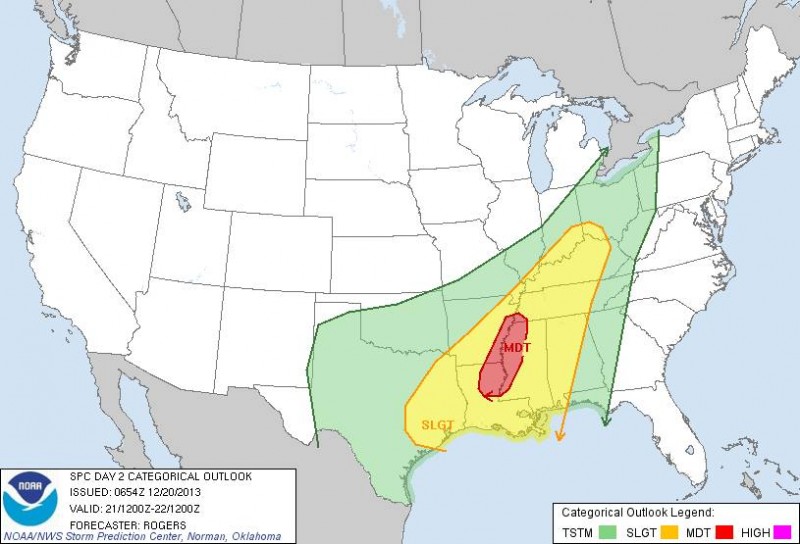
A storm system is forecast to develop across the Southern Rockies today, with its primary area of low pressure moving over the Mid South during early Saturday evening. The rapidly deepening system will produce a strong wind field across the Tennessee Valley. Winds are forecast to increase into the 50-75 mph range up to a few thousand feet above the ground during Saturday evening through Sunday morning. To the east of
the developing surface low, a line of showers and thunderstorms is forecast to develop and approach the outlook area Saturday night. This squall line should reach northwest Alabama late Saturday evening, and should move to the east of the area during Sunday morning.
Strong to damaging winds gusts, ranging from 45 to 70 mph are possible preceding and accompanying the squall line – especially in the higher elevations of the Tennessee Valley. Brief tornado development is also possible, mainly within and near breaks in the line.
Stay Weather aware this weekend, especially for those traveling for the holidays. Make sure your weather radio is working, have alerts setup on your smartphones, or have a way of finding out if severe weather is coming to your location. Have a plan and be prepared!
