
To save at-risk monarchs, think like a butterfly.
That’s what Tennessee Valley Authority scientists did.
They and experts at the Electric Power Research Institute, commonly referred to as EPRI, worked with partners to build a one-of-a-kind, award-winning model showing TVA’s lands from a monarch butterfly’s point of view.
The model ranked monarch butterfly habitats in reservoir lands, rights of way, transmission lands and power-generating plants across TVA’s seven-state service area.
With it, TVA experts could see what might be prime spots for milkweed and other flowers. That, in turn, let them plan for long-term monarch conservation.
This work matters now because the monarch butterfly is disappearing. Scientists have to be creative in protecting it and other important pollinators.
“If we can first learn what (habitat) we have, where it is, and how suitable it might be, then we can begin to make management decisions,” Holly Hoyle, TVA senior specialist with Policy and Project Management in Natural Resources, said.

Flower by Flower
Monarchs are at risk because their habitat across North America is changing, fast. Instead of being able to refuel in wildflower fields, exhausted butterflies find paved or plowed lands across much of their migration route to Mexico.
The good news is people are working to protect and add butterfly habitat before it’s too late.
“(There) is a lot of land in the southeast U.S. that isn’t developed with buildings, parking lots or roads,” Suzanne Fisher, TVA senior program manager of Special Projects and Land Use Initiatives in Natural Resources, said.
TVA already uses integrated vegetation management on lands under some transmission lines. That means that it considers what plants, people, and animals – including pollinators – need. This model will allow teams to do even more.
It helped scientists comb through hundreds of thousands of acres TVA owns or manages to identify what might be good monarch habitat and food sources, ranking the locations from best to worst. Armed with this information, they can protect the best of the best.
To do this, the GIS – Geographic Information Systems – model layered a variety of digital information.
Most people are familiar with a satellite-view map. It’s a digital photograph that shows land, trees, rivers and houses from above. Layers are information on top of that photograph. A layer could include yellow lines for roads or green shading over parks.
In the case of monarch habitat mapping, layers included land type and land cover – whether an area was city, suburb, forest, field, water or wetland, among other categories.
“Question No. 1 was what do we have, and where?” Justin Hunteman, TVA GIS and mapping program manager, said. “You’d think that’s a pretty simple question to answer, but it’s not.”
Experts in TVA’s realty group helped translate what land TVA owned and leased.
“Based on that, we were able to use the GIS software to extract … all the TVA land,” Hunteman said.
They then turned their data layers over to EPRI experts, who clipped the satellite imagery using a digital cookie cutter and added another layer of land cover to show the likelihood of certain plants growing in each area.
It involved a simple formula: Lots of milkweed plus lots of flowers equals good monarch habitat.
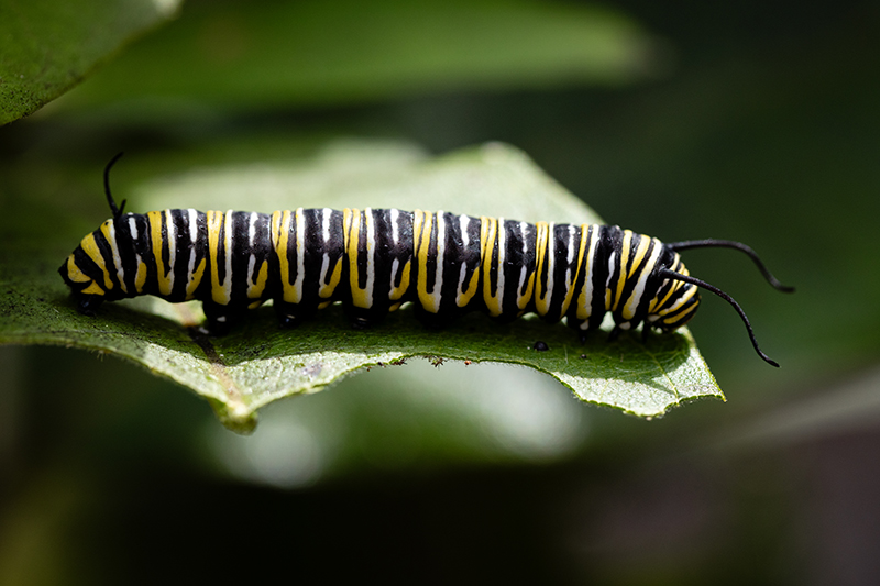
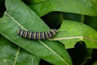
It’s simple because, to monarchs, milkweed is key.
Monarchs lay their eggs on downy undersides of milkweed leaves. Caterpillars munch milkweed until their striped bodies bulge. The leaves infuse their bodies with bitter toxins that predators hate.
Then they dangle from milkweed stems in chrysalises like green plump pea pods until they emerge, unfurl their orange wings and fly away as full-grown butterflies.
Adult monarchs aren’t as choosy. They flit from flower to flower, sipping nectar from many plant species to power a migration that takes them thousands of miles, all the way to breeding grounds in Mexico and back, over several generations.
When it’s time to lay eggs, the butterflies return to milkweed patches again.
That’s why helping the monarch is all about saving the grasslands themselves. And this plan doesn’t just help monarchs.
“Within this large amount of land, there could be habitat and resources available for … other wildlife as well,” Fisher said. “Grassland areas where a variety of food sources can grow (can) benefit all species that use the land.
Ground-Truthing
With their color-coded map complete, scientists saw that just under 50,000 acres of land could be highly or moderately suitable for milkweed. But they weren’t done yet.
“(The model) is not an indicator of definite presence of habitat,” Hoyle said.
Rather, the map just showed the most likely spots for milkweed.
The next step in modeling is ground-truthing – tromping into fields under a blazing summer sun to see if the real-life plants match the digital prediction.
If it isn’t a perfect match, the model isn’t a failure. Mismatches offer a chance for scientists to adjust the model for more accurate results.
That’s the basis of science – constant refinement of human understanding to explain real-world phenomena.
At TVA, the process of using GIS to guide sustainable on-the-ground action isn’t limited to monarch modeling.
“Our group factors in environmental modeling in a lot of other aspects,” Hunteman said. TVA specialists use models to decide where to locate solar power generation sites and where to restore river cane stands, too.

Tools for the Future
 The new model is a powerful tool to integrate TVA’s mission of providing affordable, reliable energy while protecting the region’s natural resources.
“It’s great for environmental reviews and (land) management,” Hill Henry, TVA senior program manager for environment and energy policy, said. “It’s also beneficial for any other species that become listed (as threatened or endangered by the U.S. Fish and Wildlife Service).”
The model is invaluable, too, because it’s shared.
“It was a collaboration among multiple utilities across the country,” Henry said. That means specialists at other power companies can use this tool to learn about butterfly habitats on their lands and coordinate conservation efforts nationwide.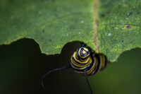
The newness and usefulness of the model led TVA experts Fisher, Henry, Hoyle and Hunteman to win EPRI’s Energy Delivery and Customer Solutions Technology Transfer award this year.
“(This model) has really good potential and highlights that TVA and other utilities are taking proactive measures to protect rare species,” Henry said.
Hoyle agreed.
“This is an opportunity to incorporate monarch conservation in TVA’s overall pollinator and biodiversity goals.”
Media Release/TVA Newsroom
