
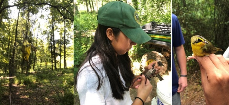
At the MAPS station, birds are extracted from the mist nets (left), biologists band and take measurements on the bird (center), and are released shortly after (right, prior to release)
MONTGOMERY-The MAPS program is a collaborative effort established to assess and monitor over 150 bird species in North America. This effort is accomplished by a network of banding stations throughout the continent. The program began in 1989, and since its inception, over 1200 banding stations have occurred throughout the states and providences in North America. In Alabama, there have been a total of 7 MAPS banding stations, with one currently conducted by biologists with the State Lands Division. For 14 years, the Wehle Nature Center has hosted a MAPS station providing a plethora of data. This year’s banding efforts resulted in over 200 banded individuals for 10 banding days spread from May to early August!
At a MAPS station, 10 fine-gauged mist nests are set up in different areas, facing different directions, to capture 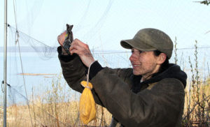 songbirds. These nets consist of four shelves, or pockets, and are approximately 20 ft long by 8 ft high. They are very hard to see with the naked eye, which is perfect for catching songbirds as they fly by. When a bird flies into the net, it falls into the pocket where it is quickly and delicately extracted by the biologist.
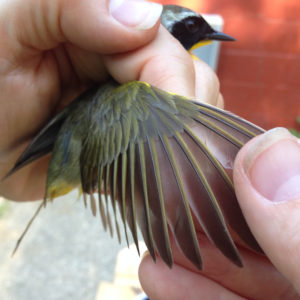
Once back to the banding table, biologists attach a band to the bird’s leg. This band does not hurt the bird and is typically metal with a specific identification number etched or engraved into the band. Once the bird is banded, biologists take other morphometrical data from the bird (e.g. wing length, weight, age, etc.), and then it is released.
 Bird banding is an essential, non-invasive, and long-term, method of bird conservation that has been used for centuries. The overall goal of bird banding is to recover or recapture previously banded birds. By doing so, we can compare the data that was initially gathered on the bird to when it was recovered which provides information on migration routes, survival, ranges, longevity, behavior, habitat use, and site fidelity to name a few. For example, this May, a previously banded Kentucky Warbler was captured in one of the 10 mist nets. Using the band number, biologists determined that it was banded during the summer of 2010 at the same Wehle MAPS station. When it was originally banded it was determined the bird was at least two years old, making the bird at least 12 years old now! Kentucky Warblers are a Neotropical migrant, which means that this bird has migrated to its wintering grounds in Central and South America and back to its breeding grounds in North America (i.e. Alabama) at least 24 times.
In the next year, our Nongame Wildlife Program plans to open a new MAPS station on ADWFF managed land. These important areas provide diverse habitats that migrating birds use as stopover, or resting, sites and breeding sites. If you are interested in supporting wildlife, including the many bird species, in Alabama, then look no further! The purchase of a Wildlife Heritage License is a great way to support the management and acquisition of new lands for birds and all wildlife in Alabama.
Media Release/Alabama Department of Conservation and Natural Resources
