TENNESSEE VALLEY-Will Sanders, a Right of Way program manager at TVA, remembers when inspecting power lines meant 50-hour workweeks on foot.
There’s still a timbre of pride as he talks about hiking some of the Valley region’s most difficult terrain in peak summer heat – watching for sagging lines, encroaching branches and other hazards that could threaten the power system.
Today, foot patrols are still used in vegetation maintenance. At the same, time new tools — such as TVA’s LiDAR-equipped airplane — have emerged.
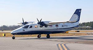
In June, TVA’s first utility-specific airplane completed its inaugural season of right of way maintenance surveys. The result: Managing more than 16,500 miles of transmission lines is now faster, safer and more cost-effective.
“For us, there has been significant cost savings than what we would spend before,” Sanders said. “What would normally go out to a contractor is now getting returned to TVA.”
The Sentinel Arrives
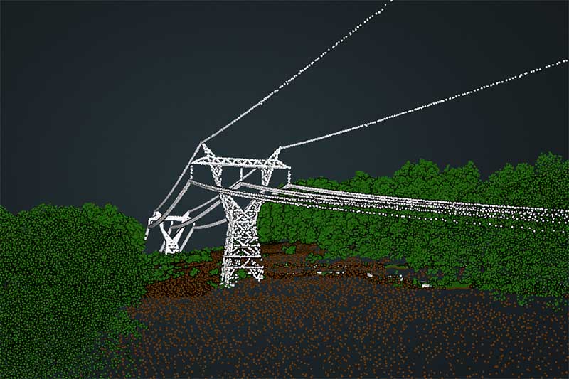
LiDAR is central to right of way management. LiDAR stands for Light Detection and Ranging, an active remote sensing technology that uses laser pulses to measure exact distances and create precise 3D maps.
Each year, TVA inspects one-third of its transmission system as part of a vegetation management cycle. Before LiDAR, inspections were labor-intensive and subjective – often relying on the judgment of aerial inspectors or foot patrol teams that could miss hazards or misidentify safe conditions, especially under fatigue.
“We do a great job,” Sanders said. “But during a 50-hour workweek, in the middle of summer, you’re not getting the same quality of work at hour 45 as you did in hour three.”
LiDAR eliminates those inconsistencies.
For years, TVA collected aerial LiDAR data using its helicopter fleet, while large-scale, fixed‑wing data acquisition was outsourced to third‑party vendors. This meant that TVA had to compete for priority on a vendor’s crowded schedule.
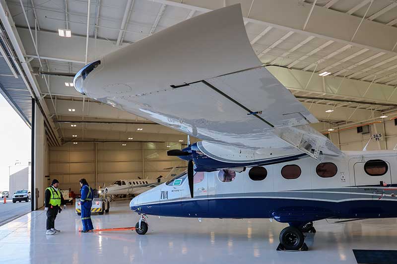
Everything changed in 2025 when the Tecnam P2012 “Sentinel” Special Mission Platform arrived at TVA Aviation’s hangar in Muscle Shoals, Alabama.
At first, TVA used a borrowed LiDAR sensor to scan about 2,000 miles of transmission lines — a training mission that allowed TVA to adapt LiDAR operations from helicopters to a fixed-wing platform.
By late 2025, TVA installed its custom‑built LiDAR sensor and launched the first full vegetation management season using the Tecnam in April 2026.
By the end of the season, Survey and Aviation teams had acquired roughly 7,000 miles of LiDAR data – one of the largest airborne data‑collection efforts in TVA history.
“That’s [more than] New York to Los Angeles and back,” Eric Donan, TVA surveyor said. “Being able to see the whole picture all at once is really what the data is bringing to the table.”
Speed to Power
Flying at 120 miles per hour, the Tecnam captures 3.5 acres of data every second. That data is processed into a 3D point cloud precise enough to identify a single leaf and powerful enough to simulate future growth patterns or forecast potential hazards months or even years in advance.
By bringing this capability in-house, TVA achieved:
- Savings of roughly half the cost of previous contracted work
- Earlier delivery of data
- Greater control over scheduling
- Improved safety for TVA employees
- Elimination of seasonal delays caused by vendor availability
“The big benefit is the speed at which it does it,” Sanders said. “It goes very fast and is able to fly high… it’s a lot safer to be out of the wire zone when doing an inspection. The safety side of things alone is a big value add.”
And while vegetation management initially justified the aircraft investment, the new in-house system produces engineering-quality LiDAR that supports both vegetation and engineering needs.
It’s rapidly becoming a multipurpose asset as TVA undertakes one of the largest new‑generation campaigns in its history.
An aerial acquisition crew is conducting imagery missions over TVA nuclear sites, and the aircraft is slated for future transmission line planning, greenfield development and infrastructure expansion projects with 3,700 megawatts of new generation currently under construction.
 TVA is also using the aircraft to support job creation in cities like Nashville, where it’s currently being deployed to make informed routing decisions for new transmission lines that are being built to support an advanced manufacturing facility near the airport.
The speed and accuracy enabled by in‑house LiDAR help TVA support customers whose success brings economic benefits to the region.
“What it gives us is huge,” Jeff Phillips, TVA Line Systems Engineering and Design manager said. “It allows us to have better data, speeds up projects and it’s more accurate in the end. It’s a great product.”
As technology continues to evolve, TVA’s investment in aerial innovation ensures the agency remains at the forefront of grid reliability and service to the Valley region.
“Aerial acquisition is a team sport and a collaboration between Aviation and Survey,” Donan said. “Safety, scale and savings targeting the annual vegetation project justified the purchase. But in turn, we can use data collection to plan, make better decisions and get power to the people faster.”
Media Release/TVA Newsroom