

TENNESSEE VALLEY-Darrell Guinn remembers listening to the morning fishing report on the radio as a child.
The radio announcer gave the Chickamauga Reservoir’s elevation, water release schedule and information about water discharge overnight. It was information his grandfather wanted as he planned for fishing in the Chickamauga tailwaters.
TVA shares all that information and more with the public through its website, with an updated Lake Levels dashboard that brings together comprehensive reservoir information.
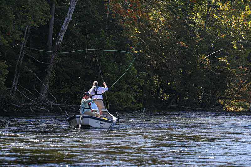
Anglers fishing in tailwaters keep a close eye on water levels and dam release schedules through TVA’s Lake Levels page.
“This new site captures everything in one page for that reservoir,” said Guinn, senior manager at TVA’s River Forecast Center.
TVA launched the update to TVA.com/lakelevels in early July, bringing together information on reservoir elevations, planned generation, recreational releases and reservoir operating guides – all in one online experience. The Lake Levels site has long been a top destination on the TVA website.
Damien Power, digital lead for TVA.com, said the Lake Levels site lets users easily find information for 49 dams, with data updated every 15 minutes.
“Just type the name of your lake, or let us find the closest one to you,” Power said of a new location feature.
The site also incorporates features that have been popular on the TVA Lake Info app, such as current weather conditions and the River Mile where dams are located.
Some of the new features include:
- Strengthened accessibility
- List of “favorites” for the reservoirs you visit most
- Multiple ways to view data, including charts or graphs
- Key terms defined
Accessibility is a priority for TVA’s website, Power said, and the new online experience keeps it top of mind.
“This site is built for everyone,” he said. “Screen readers, keyboards, high contrast – it’s all covered.”
TVA has a lot of information available to the public, and the new website makes it easy to access it whenever it’s needed, Matthew Montgomery, TVA water resources civil engineer, said.
“That builds trust between the public and TVA, further strengthening our relationships,” Montgomery said.
In redesigning the site, TVA’s digital team made it easy to explore large sets of data while also enabling users to quickly find information specific to their needs.
“People look for a variety of things,” Guinn said. “You have users who can be doing anything from fishing in the tailwaters for recreation to running a business as a fishing guide, and they depend on the release schedule because they’re booking trips for their clients.”
Users can find current conditions, including reservoir and tailwater elevations, and elevation forecast.
The generation schedule for hydropower dams shows how many generators are expected to operate, and when, for the next day. The recreational release calendars are also easily accessible.
“There’s a public safety aspect for recreational users,” Guinn said, reminding people about the dangers of fishing or boating below a dam during a water release.
And while schedules are posted, those can change without notice depending on weather conditions or power system requirements. Anyone near a dam should remain alert for signs, flashing lights or sirens that can indicate a water release.
During heavy rain, TVA can use the reservoirs and dams to control how quickly water moves through the system, preventing flooding downstream.
“There are stakeholders who have personal property that can be impacted by high-flow releases and flood-control operation,” Guinn said. “They watch that forecast of where the flow is. That’s helpful to them if they need to adjust their dock as the water goes up or down, or move a camper from a campground that may be impacted at certain levels.”
During times of drought, like this year, the Lake Levels dashboards showcase each reservoir’s operating guide. Available in chart or table view, the data compares current water levels with last year and the operating range established for each reservoir.
The Tennessee Valley watershed is still experiencing some drought conditions. While recent rainfall has helped in some areas of the western and central Valley region, the eastern Valley continues to have pockets of severe drought.
“A lot of the tributary lake levels have been abnormally low this year,” Guinn said. “The operating guide shows our target versus where the elevation is. That’s a helpful communication tool.”
Amid recent drought conditions, main river reservoirs have reached their summer pool, but many of the tributaries are below normal elevation for the year. As rain falls, some areas have gotten more rain than others.
“We try to equitably balance how we release water from those tributary reservoirs to supply minimum flows downstream,” Montgomery said.
The reservoir operating guides and release information help share that data with the public. The operating guides also help answer questions that come up each year.
Wondering when the lake will start filling up in the spring, or when the drawdown will begin in the fall? Look for the “operating range” for a reservoir – that helps you know when water levels will change.
“Whether it’s public safety, recreating or people protecting their property, the public information we provide there is beneficial to the public,” Guinn said.
Explore TVA Lake Levels to learn more.
Media Release/TVA River Neighbors

