
 -In 1972, the United States Army Corps of Engineers (COE) began construction on the Tennessee-Tombigbee (Tenn-Tom) Waterway. This project connected the Tombigbee River with the Tennessee River at Pickwick Lake in Mississippi. The construction of the Tenn-Tom Waterway created a faster route for shipping goods from the Tennessee Valley region to ports on the Gulf Coast, including Mobile and New Orleans. The waterway is the largest water resource project ever built in the United States and was the largest earth-moving project in history. In comparison, construction of the Panama Canal required 210 million cubic yards of earth to be removed, while the Tenn-Tom Waterway project required the removal of 310 million cubic yards. However, this massive project did have some negative impacts on wildlife species and habitats. An estimated 34,000 acres of bottomland hardwood habitats were impacted by the construction of the waterway.
Due to the negative effects on wildlife habitat, Section 601 of the Water Resource Development Act of 1986 required mitigation for the loss of this habitat. This act required the COE to dedicate currently owned land lands to replace the habitat losses. These lands are commonly referred to as wildlife mitigation lands. These mitigation lands created great locations for recreational activities, including hunting and fishing along the waters of the Tenn-Tom Waterway and in other locations in Alabama and Mississippi. Approximately 180,000 acres of land and shallow water are available for hunting due to this project. Of this, 126,000 acres are managed by the state wildlife agencies in Alabama and Mississippi. These areas include the David K. Nelson, Lowndes and Mobile-Tensaw Delta Wildlife Management Areas (WMAs) in Alabama. The remaining 46,000 acres are comprised of often-overlooked blocks of land scattered along the Tenn-Tom Waterway.
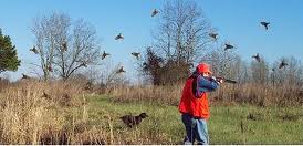 The hunting lands provided by the Tenn-Tom Waterway provide opportunities for individuals to experience small game, deer, turkey, feral hog and waterfowl hunting. The hunting rules, GPS coordinates for land locations, maps and hunting permits for the 46,000 acres along the Tenn-Tom Waterway are found on the COE website: www.sam.usace.army.mil/
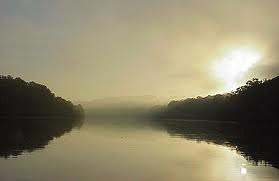 Division of Wildlife and Freshwater Fisheries and the Mississippi Department of Wildlife, Fisheries and Parks. The maps, hunting regulations, and permits for the WMAs in Alabama are found at www.outdooralabama.com. The maps, hunting regulations, and permits for the WMAs in Mississippi are found at www.mdwfp.com.
The construction of the Tenn–Tom Waterway has created economic and environmental impacts on the surrounding areas. The hunting lands and other recreational activities it provides from its beginning at Pickwick Lake downstream to Lake Demopolis will provide opportunities for current and future hunters and anglers for years to come.
MEDIA RELEASE/Justin Brock, Wildlife Biologist, Alabama Division of Wildlife and Freshwater Fisheries
