
 TENNESSEE VALLEY-Severe storms will be possible Saturday afternoon/evening into Saturday night. Damaging winds, tornadoes, hail, & heavy rainfall will be possible with these storms. NOW is the time to review your severe weather safety plan.
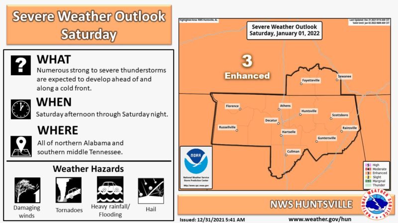
This Hazardous Weather Outlook is for north Alabama and portions of southern middle Tennessee.
The strong to severe thunderstorm threat will increase Saturday into Saturday night, as a strong cold front moves southeast across the region. Damaging winds, large hail and tornadoes, a few of which could be strong, will be possible during this time period. In addition, multiple rounds of heavy rain in the same areas may translate into a threat for flash flooding. Southerly winds will be gusty ahead of this front throughout the day on Saturday withsustained winds near 15 to 25 mph and gusts to near 35 mph.
Much colder air will move in behind the departing front on Sunday. There could be a few snow showers late Sunday before the winter precipitation ends. At this time, no accumulations or impacts are forecast.
