
50

 TENNESSEE VALLEY-The US National Weather Service in Huntsville has issued a Hazardous Weather OUTLOOK for all of North Alabama ad portions of southern middle Tennessee.
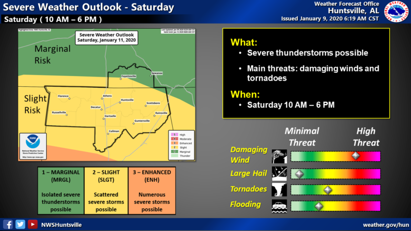
An active weather pattern is shaping up for the Valley region over the weekend and into next week. Thunderstorms are possible beginning on Friday, then strong to severe storms are expected on Saturday. Additional rainfall is likely early next week.
Statement from the National Weather Service- Huntsville:
"Strong to severe thunderstorms are expected across the Tennessee
Valley on Saturday as a vigorous storm system moves across the Deep
South. Damaging wind gusts greater than 60 mph, tornadoes, and hail
will be possible with the stronger storms.

A strong pressure gradient around this system will produce non-
severe, strong winds across the area on Saturday. Expect southerly
winds of 20-30 mph, with gusts to 50 mph in the higher terrain. Heavy
rainfall with this system may lead to additional rises on area
rivers and creeks, as well as ponding in low lying or poor drainage
areas.

Another period of moderate to locally heavy rain will impact the
area late Sunday night through Tuesday, exacerbating any ongoing
flooding and swollen rivers and creeks.

SPOTTER CALL TO ACTION STATEMENT...

Activation of storm spotters and emergency management personnel is
possible late Friday and on Saturday."
