
TENNESSEE VALLEY– The National Weather Service has issued a Flood Watch for the Tennessee Valley that will be in place from Tuesday, Febraury 19 through Thursday, February 21:
251 PM CST Mon Feb 18 2019
…FLOOD WATCH IN EFFECT FROM TUESDAY MORNING THROUGH LATE
THURSDAY NIGHT…
The National Weather Service in Huntsville has issued a
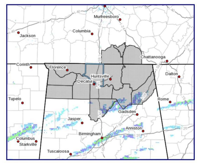
* Flood Watch for portions of Alabama and southern middle
Tennessee, including the following areas, in Alabama, Colbert,
Cullman, DeKalb, Franklin AL, Jackson, Lauderdale, Lawrence,
Limestone, Madison, Marshall, and Morgan. In southern middle
Tennessee, Franklin TN, Lincoln, and Moore.
* From Tuesday morning through late Thursday night
* Multiple rounds of heavy rainfall are expected starting Tuesday
and continuing through Thursday night. Surface soil conditions
are saturated and much of this rainfall will occur as runoff. In
addition to the excessive rainfall, releases of water along the
Tennessee River are expected to result in flooding for portions
of the river. The combination of flooding along the Tennessee
River and excessive rainfall are forecast to cause many of the
local rivers and streams to become overwhelmed and go into
flood.
* Based on the current forecasts of river levels and rainfall,
residents along the Tennessee River are advised to prepare for
flooding that resembles the Christmas Day flooding of 2015.
Residents are also advised to prepare for worst case flooding
that resembles the flooding in 2003.
PRECAUTIONARY/PREPAREDNESS ACTIONS…
A Flood Watch means there is a potential for flooding based on
current forecasts.
You should monitor later forecasts and be alert for possible
Flood Warnings. Those living in areas prone to flooding should be
prepared to take action should flooding develop.
